
Estimated reading time: 11 minutes
Landscape design has always been about creativity and precision. But as technology evolves, so do the tools designers use to create stunning outdoor spaces. One tool that’s quickly becoming a game-changer is the drone.
Using drones in landscape design offers a fresh perspective, making it easier to plan, visualize, and manage projects of any size. Whether you’re looking to save time, cut costs, or bring a unique touch to your designs, drones transform how landscapes come to life.
Let’s explore the many ways this technology is reshaping the industry.
Table of contents
- A New Perspective on Your Landscape:
- Planning Made Easier:
- Precise Measurements Without the Fuss:
- Saving Time and Money on Site Visits:
- High-Quality Aerial Photography:
- 3D Mapping and Modeling:
- Harnessing Drone Versatility for Diverse Landscape Challenges:
- Capturing Changes Over Time:
- Better Collaboration with Clients:
- Environmental Benefits of Drones in Landscape Design:
- Safety First with Drone Technology:
- Boosting Creativity and Innovation:
- Affordable for Projects of Any Size:
- Real-Time Data Collection:
- Helping with Marketing and Promotion:
- The Future of Landscape Design is Drone-Powered:
A New Perspective on Your Landscape:
Using drones in landscape design provides you with access to views you can’t get from the ground. Aerial footage offers a complete picture of your property, which can be captured quickly and efficiently.
By showcasing the entire layout in one shot, drones reveal how various elements like trees, pathways, water features, and garden beds come together. This bird’s-eye perspective helps you understand the relationship between different features of your landscape.
Designers also spot opportunities and challenges more easily. Drones help highlight potential drainage issues, shading concerns, or areas that need more attention. These things might go unnoticed at ground level but become clear from above.
With this view, you get a better sense of how everything flows. This leads to smarter, more efficient planning and a landscape design that makes the most of your space.

Planning Made Easier:
Planning your landscape design becomes simpler with drones. They provide detailed aerial maps that help you visualize the space more effectively.
Drones capture high-resolution images and data, which can be used to create accurate site maps. These maps make it easier to plan the placement of plants, structures, and other elements.
With clear visuals of your entire property, you can make better decisions about layout and design. You’ll avoid common mistakes, such as placing features in awkward locations or misjudging proportions.
Additionally, having a comprehensive view helps coordinate with other professionals. Architects, builders, and landscapers can all work from the same detailed aerial data, ensuring everyone is on the same page.
Precise Measurements Without the Fuss:
Drones make it easy to get accurate measurements for your landscape design. They can quickly capture precise data on distances and elevations and create detailed orthomosaic maps. These maps offer a seamless, geometrically accurate landscape view, correcting for distortions and ensuring precise measurements.
Using drones, you avoid the hassle of traditional surveying methods. Measurements are taken from the air, providing detailed information without the need for cumbersome equipment.
Amazon Prime is giving 6-month trial for $0
All 18-24 year-olds and students welcome.
Start your six month trial
The accuracy of drone technology and orthomosaic maps ensures that your design plans are based on exact data.
With this level of precision, you’ll reduce errors and make informed decisions. Drones’ detailed measurements and accurate mapping will make your projects more reliable and efficient.
Saving Time and Money on Site Visits:
Drones help save both time and money on on-site visits. Instead of making frequent trips to the site, you can gather all necessary information from a single drone flight.
With drones, you get a comprehensive view of your property without the need for extensive on-site inspections. This reduces travel time and minimizes disruptions to your schedule.
The ability to capture detailed footage quickly means you spend less time on manual measurements and more time on design. This efficiency translates to cost savings, as fewer site visits are required.
Overall, drones streamline the process and make your workflow more efficient. You’ll find that projects progress faster and with fewer unexpected costs.

High-Quality Aerial Photography:
Drones excel at capturing high-quality aerial photography. Equipped with advanced cameras, they provide sharp, detailed images of your landscape from above.
These high-resolution photos give you a comprehensive view of your project. You can see every element clearly, from the layout of pathways to the condition of plants. This clarity helps in making more informed design decisions.
Aerial shots are invaluable for creating stunning visual presentations. They’re perfect for showcasing your work in design models, marketing materials, and client presentations, giving a professional edge to your projects.
High-quality photos also allow you to monitor progress effectively. You can track changes, assess development, and make necessary adjustments by comparing images from different project stages. This ongoing visual record is useful for refining designs and ensuring everything stays on track.
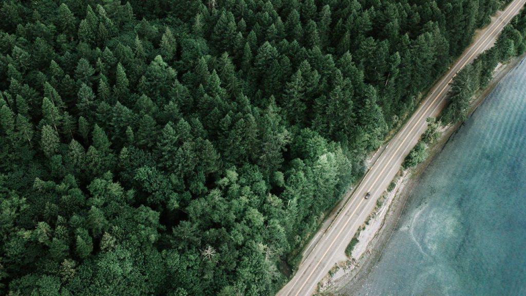
Get crystal-clear aerial photos to highlight every detail of your landscape design.
3D Mapping and Modeling:
Drones offer powerful tools for creating detailed 3D mapping and modeling. Their advanced technology captures precise data to generate accurate three-dimensional representations of your landscape.
These 3D models provide a realistic preview of your design. You can visualize how elements will look and interact in the final space. This helps in assessing design choices before any physical work begins.
Creating 3D maps also allows you to identify potential challenges early on. You can spot issues like uneven terrain or spatial conflicts, which might be harder to detect with traditional methods.
These models will later facilitate better communication with clients and stakeholders. They provide a clear, interactive view of the project, helping everyone involved understand and agree on the design.
Harnessing Drone Versatility for Diverse Landscape Challenges:
Drones’ versatility makes them even more valuable in states with diverse terrains like California. From lush coastlines to expansive deserts, California’s varied landscapes require innovative approaches.
Their ability to capture detailed aerial imagery and create 3D models is essential for tackling these unique design challenges. Drones help visualize and plan accurately, making them indispensable for projects across the state.
If you plan to relocate to take advantage of these opportunities, you will need reliable moving services. To help with your transition, consider a trusted company like armovingco.com, which offers local and long-distance moving services, packing, and storage if needed. This allows you to focus on your new projects without worrying about the logistics of your move.
Capturing Changes Over Time:
Drones are excellent for documenting changes over time. They allow you to capture time-lapse footage of your landscape as it evolves.
With regular drone flyovers, you can monitor the growth of plants, the development of structures, or any other changes in your project. This ongoing record provides valuable insights into how your design is progressing.
Tracking these changes helps you make informed adjustments. If something isn’t working as planned, you can see it in the footage and adapt your design accordingly.
Time-lapse footage also serves as a powerful tool for showcasing your work. It highlights the transformation of the landscape, which can be impressive for clients and useful for marketing purposes.
Better Collaboration with Clients:
Drones enhance collaboration with clients by providing clear, comprehensive visuals. Aerial footage allows you to present the entire project in a single view.
With high-quality images and videos, you can effectively communicate your design ideas. Clients can see how their space will look, which helps them make more informed decisions.
These visuals also help bridge gaps between your vision and the client’s expectations. You can address concerns and make adjustments based on their feedback more efficiently.
Having detailed aerial views also ensures that everyone involved in the project is on the same page. It simplifies discussions and helps align goals, leading to smoother project execution.
Environmental Benefits of Drones in Landscape Design:
Using drones in landscape design offers several environmental benefits. Drones reduce the need for heavy machinery on site, minimizing soil disruption and protecting plant life.
Their aerial approach means less physical contact with the ground. This reduces the impact on wildlife habitats and ecosystems, making your projects more eco-friendly.
Additionally, drones help in monitoring environmental conditions. You can assess soil health, water levels, and other factors without intrusive methods, leading to more sustainable design practices.
Overall, integrating drones into your landscape design process supports environmentally conscious approaches while achieving your project goals efficiently.

Safety First with Drone Technology:
Drones enhance safety in landscape design by reducing the need for manual inspections in risky areas. You can capture detailed footage of hard-to-reach or hazardous spots without putting workers at risk.
With drones, there’s no need for ladders or scaffolding. They can safely access elevated or challenging locations, minimizing the chance of accidents on site.
Using drones also reduces the need for physical contact with potentially dangerous elements, such as unstable terrain or construction zones. This decreases the likelihood of injuries during the design and installation phases.
Overall, drones contribute to a safer work environment, allowing you to focus on creating great designs while keeping safety a top priority.
Boosting Creativity and Innovation:
Drones can significantly boost creativity and innovation in landscape design. The unique aerial perspective they provide opens up new possibilities for your projects.
Seeing your landscape from above inspires fresh ideas and unconventional layouts. This bird’s-eye view helps you experiment with different designs and visualizations that might not be apparent from ground level.
Drones also enable you to explore various design options quickly. You can test different configurations and see how they work together, leading to more inventive and dynamic designs.
Incorporating drone technology into your workflow fosters a creative approach, allowing you to push the boundaries of traditional landscape design and bring innovative concepts to life.
Affordable for Projects of Any Size:
Drones make landscape design affordable for projects of any size. Whether you’re working on a small garden or a sprawling estate, drones offer valuable benefits without breaking the bank.
For smaller projects, drones provide detailed imagery and data at a fraction of the cost of traditional surveying methods. You don’t need expensive equipment or multiple site visits, which keeps expenses low.
When scaling up to larger projects, drones offer versatility and efficiency. They cover extensive areas quickly, reducing the time and resources required for data collection and site analysis.
Overall, drones offer a cost-effective solution for a wide range of projects. Their affordability and efficiency make them a practical choice, whether you’re managing a modest backyard or a large-scale landscape design.
Real-Time Data Collection:
Drones excel at collecting real-time data, providing immediate insights crucial for effective landscape design. With this data, you can make quick, informed decisions. For example, you can adjust your design plans based on current weather patterns or soil moisture levels, ensuring that your design aligns with the existing conditions.
Additionally, drones help monitor ongoing projects more efficiently. You can track progress with up-to-date footage and data, allowing you to identify and address any issues promptly. This ensures that your project stays on schedule and within budget.
Drones provide valuable, timely information that enhances your ability to adapt and respond to changing conditions. This capability helps keep your landscape design effective and relevant throughout the project’s lifecycle.
Helping with Marketing and Promotion:
Drones are a powerful tool for marketing and promotion in landscape design. High-quality aerial footage and photos showcase your projects from unique angles, highlighting their full potential.
These visuals can make a significant impact on promotional materials. For social media, websites, or brochures, stunning aerial shots attract attention and engage potential clients.
Drones also create compelling before-and-after comparisons. This helps illustrate the transformation of a space, making it easier for clients to see the value of your work.
Aerial imagery can be used in video tours or virtual walkthroughs as well. These immersive experiences allow potential clients to explore your designs from the comfort of their homes, enhancing their understanding and interest in your services.

Boost your marketing using drones in landscape design
The Future of Landscape Design is Drone-Powered:
The future of landscape design is drone-powered. As technology advances, these tools are set to become even more integral to the design process. Drones in landscape design offer precision, efficiency, and creativity that’s hard to match with traditional methods.
We can expect drones to offer even more advanced features in the coming years. Enhanced sensors, improved imaging technology, and smarter software will provide more in-depth insights and more detailed data.
Drones will continue to drive innovation in how landscapes are designed and managed. They’ll help streamline workflows, enhance collaboration, and improve the overall quality of design projects.
Embracing drone technology now positions you at the forefront of the industry. By incorporating drones into your practice, you’re not just keeping up with trends—you’re shaping the future of landscape design.
HAPPY FLYING!

I appreciate you taking the time to write and share this insightful piece. Your analysis is quite thorough, and I really enjoy reading your work. This article taught me a lot, and I will be using it again and again. You are doing an excellent job.
Thanks!!
This is a great post, I’ve already recommended it to others.
This was a valuable read, thanks for taking the time.
Thanks!