
Estimated reading time: 11 minutes
Our environment is facing a wide range of challenges. The increase in population and industrialization have caused habitat loss, climate change, deforestation, and environmental degradation.
Some wildlife has also become extinct due to this. As a result, Governments and conservationists are constantly investigating how to preserve what’s left. However, at the rate that the environment is being degraded, we need better and more effective technologies.
That’s where drones, or Unmanned Aerial Vehicles (UAVs), come in.
Drones with high-quality imaging and other types of sensors provide a wide range of benefits for conservationists. Their bird’ s-eye view allows people to monitor wildlife, map to account for what’s left, estimate the rate of degradation, and even prevent threats.
Like in many other industries, drones have proven quite useful in conservation efforts in different ways, as we will discuss in this article.
We will also highlight the challenges facing the adoption of drone technology in conservation efforts and what can be done to experience its full potential.
Table of contents
Why Drone Technology for Conservation?
Drones have come a long way in just a short time – from being huge and only used in the military to smaller drones with much more commercial and private applications.
The manufacture of miniature sensors has made it possible to make a drone a “flying computer” with the ability to fly manually or autonomously, collecting actionable insights in real-time. Below are the main technologies behind the adoption of drones.
Different Types of Drones:
Drones come in different types, each with strengths and weaknesses, each finding a use case in conservation efforts. These types include;
Fixed-Wing Drones:
Just like the name suggests, these drones feature a fixed wing, just like some manned aircraft. They take off, land from a runway like manned aircraft, and glide in a flight similar to manned aircraft.
Fixed-wing drones are known for their efficiency, as they don’t consume much battery power, allowing them to fly for longer and further. Such drones are often used in BVLOS operations within parks and reservations, long-range mapping, and extended monitoring sessions.
They are also quieter, making it easier to use them around animals. However, there are two downsides that users have to work around;
Amazon Prime is giving 6-month trial for $0
All 18-24 year-olds and students welcome.
Start your six month trial
– The need for a runway makes them harder to deploy, as you have to always be in a clearing where the UAV can take off.
– They can’t hover – Fixed-wing drones can’t hover, making it difficult to use in areas where you may have to hover for some time to observe.
Multirotor:
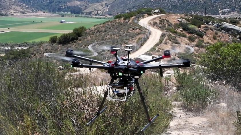
Multirotor drones use a different type of propulsion, which uses at least four propellers. Some Can have up to 10 propellers. The several propellers make it possible to take off vertically, allowing them to be used from anywhere.
A combination of propellers and FPS systems also allows these drones to hover and maintain altitude, making them useful in missions where you need to hover. However, they also consume much power and can’t fly for very long or far from the take-off point. They also make a lot of noise and could scare some animals away.
VTOL:
Also known as Hybrid drones, VTOL combines the benefits of a fixed-wing and a multirotor. They can take off like a multirotor, allowing them to be used from anywhere as they don’t need a runway, and once they take off.
They switch to a fixed-wing, allowing them to utilize the efficiency of a fixed-wing system. When necessary, they can switch to the multirotor system for hovering. While they may consume a little more power than a fixed-wing, they offer longer flight times than multirotor, making them a versatile tool for a wide range of conservation activities.

Main Features of Drones Used in Conservation:
Below are the main technologies that enhance drone operations for conservation efforts.
GPS and GNSS Systems:
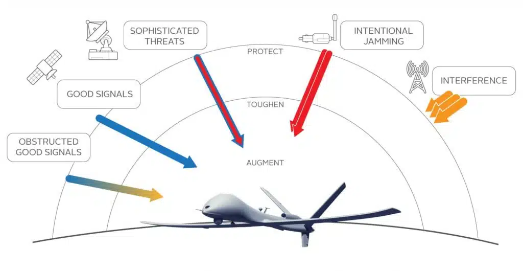
As mentioned earlier, GPS systems allow a drone to hold its position in the air and maintain altitude. But that is not the only use of GPS—it also allows waypoint missions, making it possible to automate flights. GPS and GNSS systems also enable navigation, making mapping and exploring remote areas possible.
Thermal Imaging Sensors:
Thermal imaging sensors make it possible to detect humans, animals, and other objects at night or in low-light conditions, extending the use cases of drones in conservation, as we will discuss in detail.
High-Quality Imagery Sensors:
In well-lit environments, a high-resolution sensor can help you collect high-res images and videos to help identify species, count them, or create maps.
Other Sensors:
Drones can also be fitted with temperature, pH, pressure, magnetic, and many other sensors for aerial and underwater data collection to help better understand the environment.
AI and Machine Learning:
AI and machine learning have revolutionized several industries, including the drone industry. Regarding conservation and drones, AI and machine learning can help automate and accelerate processes and create accurate prediction models.
Real-Time Data Transmission:
A drone’s ability to transmit live feed makes it valuable for observing animal behavior or monitoring a sanctuary in real time.
Data Integration with Other Technologies:
The ability to integrate drone data with technologies like GIS, Remote Sensing, and Satellite imagery platforms extends their applications in conservation.
Role of Drones in Conservation:
Now that we have established the main aspects of drone technology, let’s discuss how this directly or indirectly affects conservation efforts.
Wildlife Monitoring:
A combination of high-res sensors, AI, and the ability to observe from further distances makes drones a viable tool for wildlife monitoring.
Researchers have used drones to observe wildlife migration patterns, daily living, and even specific events such as mating and reproducing.
By observing from an aerial view with zoom cameras, researchers can catch animals such as elephants, rhinos, birds, and other endangered species in their natural habitat without disturbing them. For instance, drones have been used to monitor nursing humpback whales in their breeding grounds with the aim of understanding more about the species.

Prevent Poaching:
Drones are a valuable tool for anti-poaching operations thanks to real-time live feeds, aerial view, long-range travel, thermal imaging, and AI.
Thermal imaging allows users to conduct daily and night surveillance or even in areas with low lighting. AI can help enhance threat analysis by automatically detecting intruders or things out of the norm, or even developing models to predict threats.
Real-time feeds enhance rapid response in case a threat is detected. Drones also cover much more ground than foot and vehicle patrol, and are cheaper and more accessible than helicopters. And with several drones, it is possible to always be aware of what is going on in a huge area.
Deploying drones first also ensures the safety of the security teams by scanning the area first, preventing ambushes, and minimizing the need for them to go to inaccessible areas unnecessarily.
A good example is a project in Botswana where drones and AI were used for anti-poaching efforts. They trained the AI based on drone footage, automating threat detection.
Prevent Human-Animal Conflict:
Drones with high-res cameras and thermal imaging can be used for regular patrols to detect animals that may get too close to human settlement.
Once identified, the drones themselves can be used to drive the animals away from the settlements. Trained ranges can also be deployed to prevent what would otherwise be a disastrous occurrence.
An example of such a project is the Mara Elephant project, in Kenya, that deploys drones in areas prone to conflict between people and elephants.
Mapping and Restoring Environments:
Drones with high-resolution sensors and multispectral or LiDAR sensors can be used to map habitats or areas affected by fires, floods, and other disasters. When combined with satellite imagery, researchers and conservationists can detect changes in land cover, identify areas impacted by deforestation, and develop plans for restoration.
Larger drones can also be fitted with dropping mechanisms to drop seed balls in areas affected by deforestation, especially areas where vehicles or people on foot can’t access.
Drones also have the potential to plant at a faster rate than planting manually.
Companies like BioCarbon have set to use drones to map millions of trees annually to curb the growing rate of deforestation.
Various countries have used drones during wildfires to map patterns and stop the fires, predict fires before they happen to stop them, and even in search and rescue.
Marine Life Conservation:
Earlier, I mentioned drones being used to monitor whales deep in the sea. But that’s not all.
Aerial and underwater drones can also be used to monitor coral reefs to identify coral reef degradation, monitor marine life, detect the effects of human influence, and detect illegal fishing, among other uses.
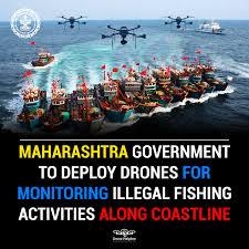
According to a recent news piece, drones are being deployed for coastal surveillance in Maharashtra to detect illegal fishing. To curb the loss Africa experiences due to illegal fishing (up to USD $2.3 Billion), Badr Idrissi, Founder of ATLAN Space, developed a solution combining drones and AI.
They feed the drones with information such as the hotspots for illegal fishing and weather, and they can detect illegal activities by identifying patterns.
Detect Invasive Species:
Through mapping, researchers can identify invasive plants and animals, identify the specific locations and how the invasive species interacts with the environment, and develop strategies to eradicate them.
After identifying these species, larger drones like the DJI Agras drones can be used to spray chemicals if that is the chosen way to eradicate them. During a locust pandemic that destroyed both planted and natural vegetation in East Africa, drones were used to spray them and also scare them away.
The same has been used as a temporary measure with invasive birds. In the Galapagos Islands, drones from the Charles Darwin Foundation have effectively identified a rat infestation and eradicated it by dropping rodenticide. They also accomplished a similar project to identify invasive plants.
Community and Stakeholder Engagement:
Drones can be used to create footage for educational materials, educating students, the community, and stakeholders on the importance of conserving the environment. Drone footage is instrumental in enhancing educational materials for all levels of education.
Challenges of Using Drones in Conservation Efforts:
Below are some limitations facing drone usage in conservation.
Regulatory Restrictions:
Drones are governed by strict restrictions on where to fly, how high to fly, and the need for certain permits before they can fly.
For instance, BVLOS operations are much more challenging to get approvals for, limiting some drone projects.
The good thing is that the regulatory landscape is evolving, and a more comprehensive framework is being developed, but some countries are still lagging.
Risk of Scaring Away the Animals:
While drones can observe from a distance, sometimes you may have to get close. This could scare away the animals, preventing you from observing them in their natural state.
Some birds may also crash into the drones as they fly away, causing damage to the aircraft and also hurting or even killing the animals.
High Initial Costs:
Some companies or governments may find the costs of purchasing and maintaining drones, software, and personnel training too high, especially when they are not certain of the results.
Privacy Concerns:
Some conservancies and communities close to them may not be willing to use drones since they are equipped with cameras and may be used maliciously. Community engagement and awareness are always essential, but they are not always enough to convince them.
Conclusion:
Drone technology has a very significant role in conservation efforts. From wildlife monitoring, supporting anti-poaching efforts, behavioral studies, marine conservation, detecting and eradicating invasive species, preventing human-animal-conflict, and restoring environments.
The ability of drones to carry different sensors, observe the subject from a distance, send a live feed, and work with other platforms makes them applicable in these use cases and many others that researchers can think of. While challenges like regulatory restrictions, the risk of scaring animals away, high costs, and privacy concerns limit some applications, the benefits outweigh the risks.
And with more advancements in AI and machine learning, batteries that can last longer, more sensors, and other inventions, we can see more adoption of drones in more areas of conservation.
HAPPY FLYING!
